Animations of the winds in the 3rd domain
(1.11 km grid spacing) for the region shown are below.
 |
 |
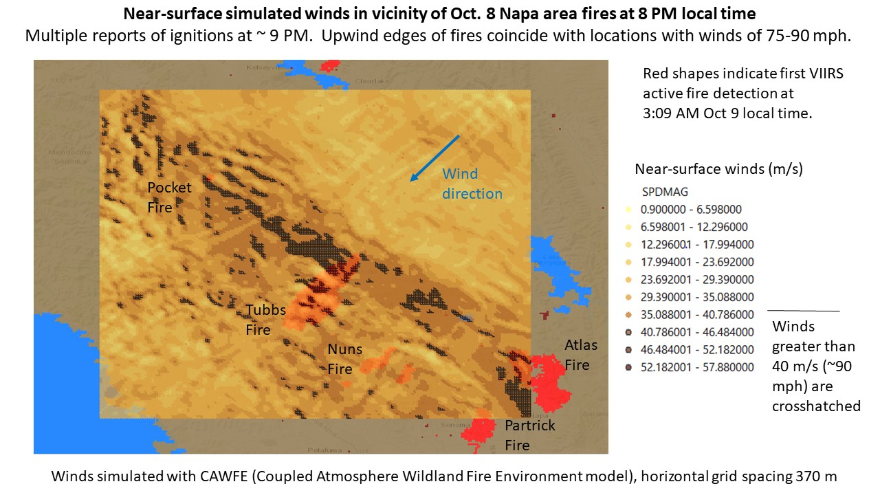
Simulated near-surface wind at 9 PM PDT. Wind speed arrows point downstream and are colored according to the color bar at right. Imagery produced by VAPOR (www.vapor.ucar.edu), a product of the Computational Information Systems Laboratory at the National Center for Atmospheric Research.
Animation: mp4 format (183 Mb)
Copyright 2018, UCAR | Privacy Policy | Terms of Use | Dr. Janice Coen is a Project Scientist in the Mesoscale and Microscale Meteorology Laboratory, which is part of NSF NCAR, administered by UCAR, email: janicec@ucar.edu . The NSF National Center for Atmospheric Research is sponsored by the National Science Foundation. Any opinions, findings and conclusions or recommendations expressed in this publication are those of the author(s) and do not necessarily reflect the views of the National Science Foundation.