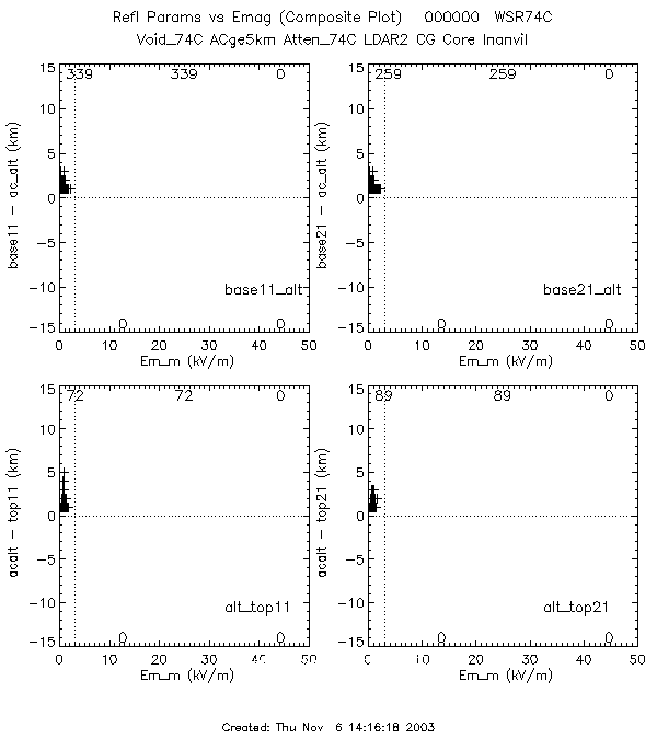
To determine when the aircraft was above or below cloud the flight level was compared to the top or base of the cloud. The merged files were used so the top11x11 and top21x21 were both examined (similarly for the base11x11 and base21x21). This allowed for an additional filter.
The filters used were the same as the ones in the Scatter_Plot directory labeled lmin (lightning and minimum filter):When the filter for restricting the aircraft to be above or below cloud was included there were no occurrances for the WSR74C where the Emag was greater than 3 kV/m. WSR74C (Directory)
For NEXRAD there were a few. NEXRAD (Directory)| date | alt_top11x11 (total of 17) | alt_top21x21 (total of 18) |
| 000604 | 0 | 3 |
| 000613 | 6 | 5 |
| 000628 flt 2 | 11 | 10 |
In all of the cases a look at the data shows the aircraft is NOT out of the cloud (dBZ at the aircraft was greater than or equal to at least 5 dBZ) and the aircraft altitude minus the top was 1 (one). This is probably due to the averaging method chosed for determining the top of the cloud. Where there can still be reflectivity at the aircraft, and yet the average cloud top might be just below the aircraft level.
So the conclusion of this is there are no cases where the aircraft was flying above or below the cloud measuring an Emag of > 3 kV/m.