|
New 5-minute Soil Data and 30-second Landuse Data in TERRAIN
In V3.5, the soil category, and vegetation data are updated.
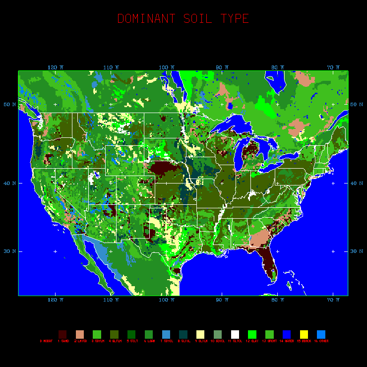
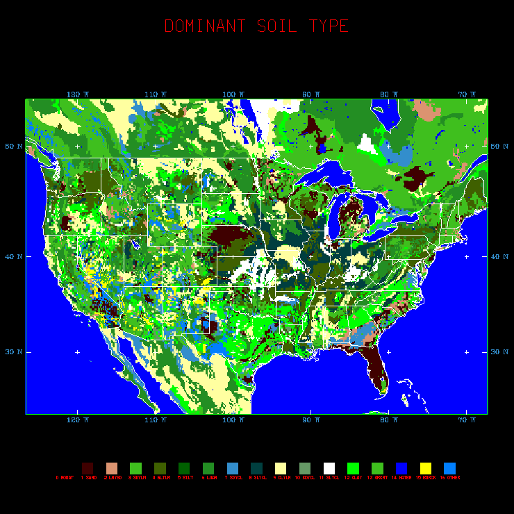
The soil category data are updated with the United
Nation/FAO 5-minute global dataset. We have combined the 5-minute
data with the STATSGO 30-second CONUS data to create soil category
data at all six resolutions (60, 30, 10, 5 and 2 minutes and 30
seconds). In addition, two layers of soil category data are provided:
one for top soil layer in 0 - 30 cm layer, and one for bottome soil
layer in 30 - 70 cm layer.
-
Click here to see a map of top
soil data over Continental US produced on a 15 km grid using
5-minute input data.
-
Click here to see a map of bottom
soil data over Continental US produced on a 15 km grid using
5-minute input data.
Over the Antarctic, soil type is assumed to be glacier (the
FAO dataset didn't provide data over Antarctic) which is the
same as we had previously.
Over Hawaii, the 5-minute data show improvement over what
was available before.
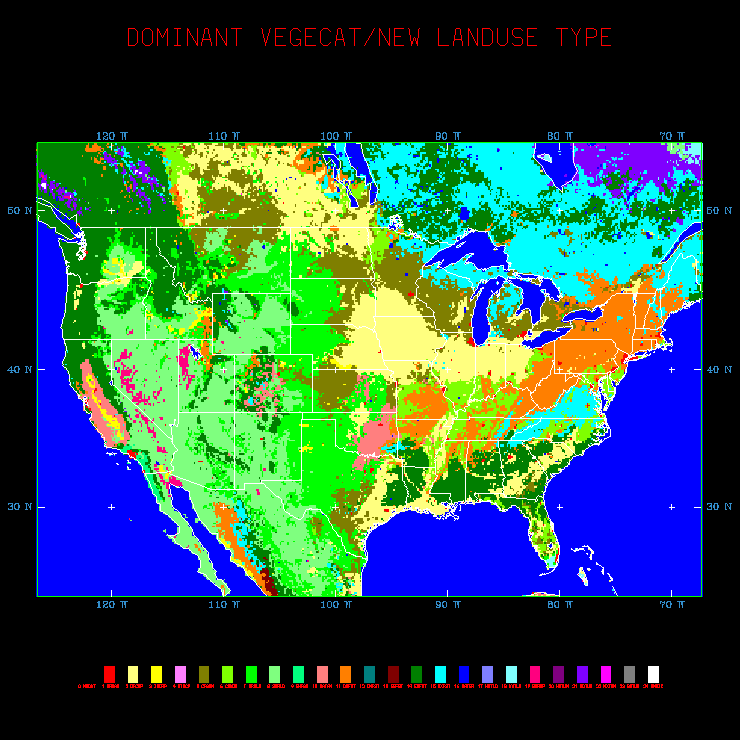
The new landuse data are updated with the Version 2 USGS land-cover
data (see http://edcdaac.usgs.gov/glcc/glcc.html).
There are some changes over parts of the world in this newer
dataset as compared to what we had before.
-
Click here to see a map of updated
landuse over the Continental US produced on a 15 km grid using
5-minute input data.
Over Hawaii, the new landuse data provided urban category
but none others. The rest of the islands are filled with dominent
landuse category over the similar latitudes, which turns out
to be mixed forest (category 15 in USGS dataset). The previous
landuse over the islands was savanna (category 8).
|
