Graphics: NCL - Example
Below is a series of basic plots showing how to create a plot for WRF ARW data. The basic plotting techniques shown here can be used for any wrf data file.
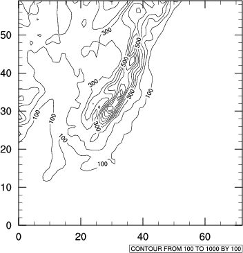
In this plot no special WRF functions are used.
A single field is simply read from the file
ter = a->HGT_M(0,:,:)and plotted
plot = gsn_contour(wks,ter,True)Add shading to the plot
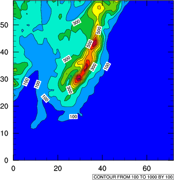
res = True
res@cnFillOn = True
res@gsnSpreadColors = True
plot = gsn_contour(wks,ter,res)Change the plot levels
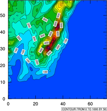
res@cnLevelSelectionMode = "ManualLevels"
res@cnMinLevelValF = 0.
res@cnMaxLevelValF = 1000.
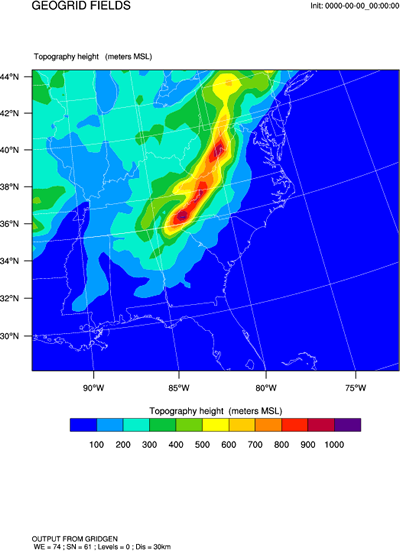
res@cnLevelSpacingF = 50.Up to now none of the plots had a map background. Adding a map over WRF ARW data is not trivial, so let's rather use some special WRF-NCL scripts to do this.
Make sure to first load the special scripts:
load "$NCARG_ROOT/lib/ncarg/nclscripts/wrf/WRFUserARW.ncl"Create the color fill terrain plot (add a header at the same time):
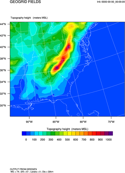
opts = True
opts@MainTitle = "GEOGRID FIELDS"
res = opts
res@cnFillOn = True ; Create a color fill plot
contour = wrf_contour(a,wks,ter,res)Overlay plot onto a map (using default plot and map setting):
pltres = True
mpres = True
plot = wrf_map_overlays(a,wks,(/contour/),pltres,mpres)
Change the default plot levels before creating the plot:
res = opts
res@cnFillOn = True ; Create a color fill plot
res@ContourParameters = (/ 0., 1000., 50. /)
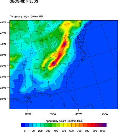
contour = wrf_contour(a,wks,ter,res)Remove initial time and footers from plots:
opts = True
opts@InitTime = False
opts@Footer = FalseChange the default map and grid color to Black:
mpres = True
mpres@mpGeophysicalLineColor = "Black"
mpres@mpGridLineColor = "Black"
mpres@mpLimbLineColor = "Black"
mpres@mpNationalLineColor = "Black"
mpres@mpPerimLineColor = "Black"
mpres@mpUSStateLineColor = "Black"