General Info

About wrfhelp

wrf-news list

WRF Workshop

WRF Tutorial


namelist.wps: Best Practices

The following is a basic namelist.wps file that is used for running the WRF Preprocessing system (which includes geogrid.exe, ungrib.exe, and metgrid.exe). Click each listed variable for a description of the function, as well as best-practices for each, if applicable.

In namelist.wps, multiple columns are used for multiple domains; however max_domains determines how many columns will be used. For example, if you use 3 columns, but only set max_dom = 2, the last column will be ignored.
NOTE: Not all parameters have mulitple columns. Do not add additional columns for single column parameters, or you will receive an error.

&share
wrf_core = 'ARW'
max_dom = 2,
start_date = '2019-09-04_12:00:00','2019-09-04_12:00:00',
end_date = '2019-09-06_00:00:00','2019-09-04_12:00:00',
interval_seconds = 10800,
io_form_geogrid = 2,
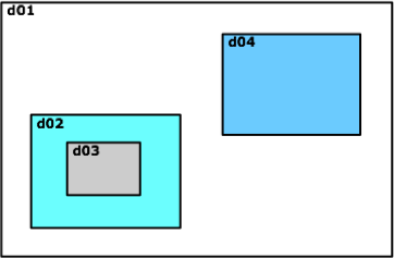
active_grid = .true.,.true.,
/

&geogrid
parent_id = 1, 1,
parent_grid_ratio = 1, 3,
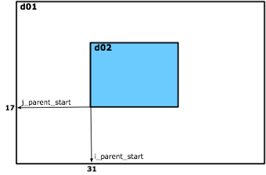
i_parent_start = 1, 53,
j_parent_start = 1, 25,
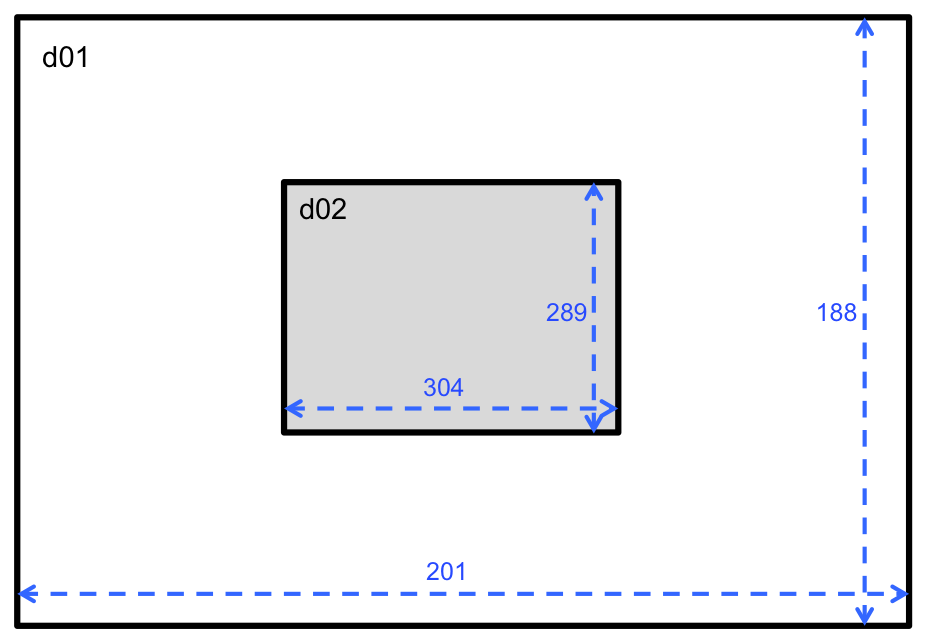
e_we = 150, 220,
e_sn = 130, 214,
geog_data_res = 'default','default',
dx = 15000,
dy = 15000,
map_proj = 'lambert',
ref_lat = 33.00,
ref_lon = -79.00,
truelat1 = 30.0,
truelat2 = 60.0,
stand_lon = -79.0,
geog_data_path = '/glade/work/wrfhelp/WPS_GEOG',
opt_geogrid_tbl_path = '/glade/work/wrfhelp/shared_tables/GEOGRID.TBL',
opt_output_from_geogrid_path = '/glade/work/wrfhelp/my_output/',
/

&ungrib
out_format = 'WPS',
prefix = 'FILE',
/

&metgrid
fg_name = 'FILE',
constants_name = '/glade/work/wrfhelp/input_data/constant_file',
io_form_metgrid = 2,
opt_metgrid_tbl_path = '/glade/work/wrfhelp/shared_tables/METGRID.TBL',
opt_output_from_metgrid_path = '/glade/work/wrfhelp/my_output/',
/


&share

wrf_core
A character string set to either 'ARW' or 'NMM.' This tells WPS for which dynamical core the input data are being prepared. If you have compiled WPS for use with WRF-ARW, leave this set to 'ARW.'
max_dom
An integer specifying the total number of domains/nests, including the parent domain, to be used in the simulation.

Best Practice
Nested domains are necessary when scaling down from coarse first-guess (input) data to a finer resolution. Recommended ratios for coarse input data resolution to the parent domain are odd ratios of 3:1 or 5:1. For example, say ou need to use a resolution (dx) of 3 km to resolve features you are interested in, and your input data have a resolution of 27 km. If you use a 3:1 (parent_grid_ratio) ratio, domain 01 should be around 9 km, with a nested domain with 3 km grid spacing. In this case, max_dom = 2.
start_date
A string of numbers specifying the beginning date and time of the simulation. This should be in the format of YYYY-MM-DD_hh:mm:ss.

Note: You must have input data or forecast data for this particular date and time in order to run a simulation for this time period.
end_date
A string of numbers specifying the ending date and time of the simulation. This should be in the format of YYYY-MM-DD_hh:mm:ss.

Notes: You must have input data or forecast data that goes through this particular date and time in order to run a simulation through this time period.

Notice in the example above, the end_date for the nest is the same as the start_date. This is okay because domain two will get its boundary information from domain one. However, if the sst_update option, or any type of nudging will be used during wrf, the full date/time span should be set for nested domains in namelist.wps.
interval_seconds
The temporal interval in which the input data are available (in seconds). If the data are available every 3 hours, this should be set to 10800, for example.

Best Practice
It is best to use the highest time frequency data available.
io_form_geogrid
The format in which geogrid output files (geo_em* files) will be.

1 = Binary
2 = netCDF
3 = GRIB1

Best Practice
The metgrid program will expect netCDF format, so unless you have modified your code to allow other types, leave this set to '2.'
active_grid
A list of logical values specifying, for each grid, whether that grid should be processed by geogrid and metgrid. Default value is .true..

Note:
This is an optional namelist parameter that is not included in the default namelist.wps. It is not necessary to add it if you do not want to turn off the executation of metgrid or geogrid for one of the domains.


back to top of page


&geogrid

parent_id
This is the domain number (ID) of each domain's parent. The coarsest domain (d01) should be set to 1. The example below shows a fairly complicated domain set-up to help with explanation for how to set this parameter. In this example, there are 4 domains (numbered as shown). For this particular example, the setting would be

parent_id = 1, 1, 2, 1

because both d02 and d04 have d01 as a parent, while d03 has d02 as a parent.

    
parent_grid_ratio
The nesting ratio relative to the domain's parent. For the coarsest domain, parent_grid_ratio should be set to 1.

Best Practice
Recommended ratios are 3 or 5. If you are unfamiliar with the model, it is best to leave this set to 3. It is not recommended to use an even number ratio since it is best to have a center grid cell for the fine domain that corresponds with the center of the coarse domain.
grid cell.

cost: Assuming a 3:1 ratio and the same number of grid cells in the parent and nest domains, the fine grid will require 3x as many time steps to keep the pace of the coarse domain.
i_parent_start
and
j_parent_start
The x and y (or i and j) coordinates of the lower left corner of the nest in the parent domain. For the coarsest domain, a value of 1 should be specified for both i and j.

Example:
i_parent_start = 1, 31,
j_parent_start = 1, 17,


Best Practice
It is good practice to keep nest boundaries away from coarse domain boundaries, and to keep them away from steep topography. As a rough approximation, keep about 1/3 of the coarse-grid domain surrounding each side of the nest. This does not have to be exact, and the nest does not have to be centered perfectly, but this helps to prevent problems later. If the prevailing winds are westerly, and the nest will not be centered, it is better to place the nest further away from the west boundary, than the east.

When using nests, start by setting up one domain, then use a program such as ncview or plotgrids.ncl to explore the nest starting and ending locations of the coarse domain. Your nest domain dimensions will be (ending index - starting index)*3+1
e_we
and
e_sn
Each domain's full west-east and south-north dimensions (or grid spaces)

Example:
e_we = 201, 304,
e_sn = 188, 289


For nested domains, e_we and e_sn must be one greater than an integer multiple of the nest's parent_grid_ratio. This is to ensure that a nest always starts and ends on a parent grid point. (i.e., e_we=n*parent_grid_ratio+1 for some integer n).

Best Practice
Domains should not be smaller than 100x100 grid spaces. Note that there will be about 10 grid points (minimum of 5) on each side, in the boundary zone. If domains are too small, the solution will be determined by forcing data, which defeats the purpose of running a simulation.

When considering the size of the coarse domain, there is no need to be economical. Doubling the size of the coarse grid domain will only result in a 25% nested forecast time increase. It is also important to consider the speed at which systems are moving through the simulated region. A multi-day forecast needs a much larger domain than a short forecast. If cost is prohibitive, consider adding an external domain.
geog_data_res
Resolution of source data to be used when interpolating static terrestrial data. The default setting uses MODIS IGBP 21-category data


Notes:
If you wish to use USGS static terrestrial data, instead of the default MODIS data, geog_data_res should be specified as:
geog_data_res = 'usgs_30s+default', 'usgs_30s+default',
Prior to V3.8, USGS was the default. If you are using a version of WPS that is prior to V3.8, and you wish to use the default USGS data, then it is only necessary to specify:
geog_data_res = '10m', '2m', '30s'
Prior to V3.8, if you wish to use the MODIS data, it would be necessary to specify:
geog_data_res = 'modis_30s+10m', 'modis_30s+2m', 'modis_30s+30s'
Possible available resolutions are 10m (~19km), 5m (~9km), 2m (~4km), and 30s (~0.9km).

When there are multiple resolutions available for geographical input data, choose a resolution that is slightly better than your grid resolution. For example, if your grid resolution is 9km, using 2 minute static data would be ideal.
dx
and
dy
Grid distance (or grid resolution) in the x and y directions.

This is given in meters for the Lambert, Polar, and Mercator projections. For the 'lat-lon' projection, this is given in degrees latitude. Only the coarse domain resolution needs to be specified, as nest domains will be calculated based on parent_grid_ratio.

Best Practice
It is recommended that dx and dy have the same value for Mercator, Polar, and Lambert projections.

See the description for
parent_grid_ratio for relevant/useful information for this parameter.
map_proj
A character string specifying the projection of the simulation domain (all domains must use the same projection). For ARW, accepted projections are 'lambert', 'polar', 'mercator', and 'lat-lon.'

Best Practice
lambert: well-suited for mid-latitudes; domain cannot contain poles; domain cannot be periodic in west-east direction

mercator: well-suited for low-latitudes; may be used for a "channel" domain (periodic in west-east direction).

polar: good for high-latitude domains, especially if the domain contains a pole

lat-lon: also called cylindrical equidistant; required for global domains (but does not have to be global); can be used in its normal or rotated aspect.

It is best to check the range of the map scale factor (e.g., MAPFRAC_M for the map factor in the center of a grid cell) after running geogrid.exe (this can be checked easily with the ncview program). Values should be close to 1 to ensure the projection is not causing distortion.
ref_lat
and
ref_lon
Real values specifying the latitude and longitude of a location whose (i,j) location in the simulation is known.

For ARW, ref_lat and ref_lon give the latitude and longitude of a known location in the domain (it's recommended that these are set to the center of the coarse domain - To change this, ref_x and ref_y must also be specified - see the
WPS chapter of the WRF User's Guide for more informationi).
truelat1
A real value specifying the first true latitude for the Lambert conformal conic projection, or the true latitude for the polar stereographic projection, or the Mercator projection.
truelat2
A real value specifying the second true latitude for the Lambert conformal conic projection.
stand_lon
A real value specifying the longitude that is parallel with the y-axis in conic and azimuthal projections.

Best Practice
If this longitude is set to the same value as ref_lon, your coarsest domain will be centered.
geog_data_path
A string that represents the location where the static geographical data is stored.

Best Practice
It's best to set this to the absolute path, as occasionally problems can occur when using relative paths or symbolic links.
opt_geog_tbl_path
A string that represents the location where the GEOGRID.TBL (that you wish to use) is stored.

Best Practice
This is an optional parameter that can be useful if you are using shared compiled code.
opt_output_from_geog_path
A string that represents the location where you would like to store your geogrid (em_geog*) files.

Best Practice
This is an optional parameter that can be useful if you are running in a shared directory, if you do not have permission to write to the WPS/ running directory, or if you do not have enough room to write to the WPS/ directory.


back to top of page


&ungrib

out_format
The format of the intermediate file. The options for this are "WPS," "MM5," and "SI." If you are running ungrib in the WPS/ program, this should be set to "WPS."
prefix
The prefix that will be assigned to intermediate files (produced from the ungrib.exe program). This can be left as set to 'FILE' or can be changed to any name you choose.

Best Practice
If you will be using more than one type of input data, and will need to run ungrib twice, you may consider setting this to something that is meaningful to the data type (e.g., "SST" for sea surface temperature data). If you do need to run ungrib twice, set this to only one prefix name per ungrib.exe run.


&metgrid

fg_name
This is the prefix that was used when the intermediate files were created (see above). To combine different data sources, list all prefixes (e.g., fg_name = 'FILE','SST'). Note that when multiple path-prefixes are given, and the same meteorological field is available from more than one of the sources, data from the last-specified source wil take priority over all preceding sources.
constants_name
A list of character strings specifying the path and full filename of ungribbed data files which are time-invariant. The path may be relative or absolute, and the filename should be the complete filename; since the data are assumed to be time-invariant, no date will be appended to the specified filename. Default value is an empty list (i.e., no constant fields).

This is an optional namelist parameter.
io_form_metgrid
The format in which metgrid output files (met_em* files) will be.

1 = Binary
2 = netCDF
3 = GRIB1

Best Practice
The real.exe program will expect netCDF format, so unless you have modified your code to allow other types, leave this set to '2.'
opt_metgrid_tbl_path
A string that represents the location where the METGRID.TBL (that you wish to use) is stored.

Best Practice
This is an optional namelist parameter that can be useful if you are using shared compiled code.
opt_output_from_metgrid_path
A string that represents the location where you wish to store your metgrid output (met_em*) files.

Best Practice
This is an optional namelist parameter that can be useful if you are running in a shared directory, if you do not have permission to write to the WPS/ directory, of if you do not have room to write the files to the WPS/ directory.


back to top of page


Home -- Model System -- User Support -- Doc / Pub -- Links -- Download -- WRF Real-time Forecast