This is a case of a long-lived MCV that is associated with secondary
convection. A medium-sized MCS forms in eastern Colorado during
the evening (0000 - 0500 UTC 20 August). This MCS weakens after
midnight but leaves an MCV in its wake that moves northeastward
into Nebraska by the following morning (1200 UTC 20 August). The
visible satellite imagery illustrates new convection forming on
the downshear flank of the MCV by early afternoon over central Nebraska.
Convection becomes more widespread during the late afternoon and
early evening and extends well to the east and northeast of the
MCV along a surface cold front. However, this convection dissipates
prior to midnight (0600 UTC 21 August) and convection that reforms
farther to the west over eastern Nebraska (close to the position
of the MCV in the early evening) develops into a medium-sized MCS
that persists overnight. This MCS dissipates over southwestern Iowa
shortly after sunrise (1200 - 1400 UTC 21 August). This dissipated
MCS also leaves an MCV in its wake, which is particularly evident
in the visible satellite imagery at midday on 21 August (1800 UTC).
The MCV moves slowly eastward into a drier and less unstable environment
and is not associated with any further organized convective systems.
Key GIF Images
composite map (0000 UTC 20 August - 1200 UTC 21 August)
surface ict (0000 UTC 20 August - 0000 UTC 22 August)
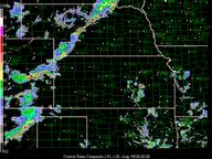
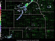
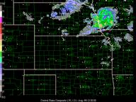
nexrad cent_plains (0000 UTC 20 August - 1500 UTC 21 August) gap
1900-2230 20th
nexrad cent_missvly (0000 UTC 21 August - 0300 UTC 22 August)
sat irmb (0000 UTC 20 August - 0000 UTC 22 August)
sat ict (1200 UTC 20 August - 0100 UTC 22 August)
sat evv (1200 UTC 21 August - 0100 UTC 22 August)
profiler msl_wp (0000 UTC 20 August - 0000 UTC 22 August)
profiler agl_wp (0000 UTC 20 August - 0000 UTC 22 August)
NCAR is sponsored by the National Science Foundation